|
The Osiris atlases are built from the Osiris suite of databases packaged to provide the most helpful information for explorationists and environmental and governmental decision-makers.
The Osiris suite includes atlases showing the present-day geomorphological and drainage analysis of each geographic area, with reconstructions of the evolving drainage through time together with its associated hinterland. Osiris comprises a suite of fully integrated and audited global, spatial data- and knowledge-bases including drainage and landscape analyses, morphometrics for present-day river systems, provenance analyses, bedrock geology, and reconstructions of river evolution. Osiris is designed to enable users to investigate terrestrial sediment production and transport as part of source-to-sink analyses, especially regarding reservoirs, aquifers, and placer deposits. This information is a crucial input for paleogeographic restorations. This is done by analyzing river networks to identify possible changes in transport pathways (Landsat and radar data). Investigation of hydrological information, sediment flux, provenance, and geological history to provide hypotheses of probable drainage evolution through time. Mapping bedrock geology using remote sensing techniques to generate paleo-bedrock maps for estimating compositional changes to sediment fluxes through time. |
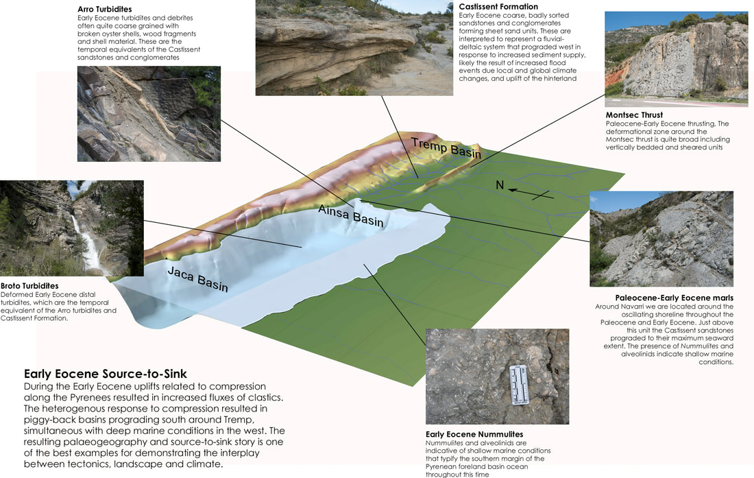
An example image from our course on Pyrenean source-to-sink with outcrop examples superimposed on a paleogeography map
|
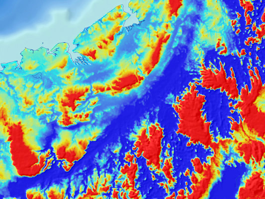
Osiris Madagascar
The complete Osiris atlas brings together bedrock geology, drainage analysis, and drainage evolution as part of a source-to-sink analysis of the island of Madagascar. Although there continues to be interest in hydrocarbon exploration around the margins, especially the Majunga and Morondava basins, a significant focus for Madagascar is mineral exploration.
|
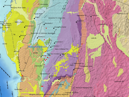
Atlas of Madagascan Bedrock Geology
This was the first area where we tested out our new methodologies for capturing bedrock geology. The result is a geospatial database fully integrated with our structural and crustal interpretation databases (Reclus suite) and containing stratigraphic, depositional environment, and lithological information.
|