Our paleogeographic atlases build on over 30 years of experience. Atlases are provided as digital and hardcopy solutions at three scales depending on your needs: Global, Regional, Basin.
Paleogeography provides the spatial context for problem-solving in the past as a representation of the past surface of the Earth.
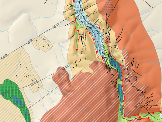
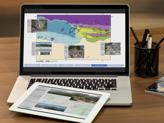
We have developed a new operational workflow for building paleogeographies which we are experimenting with currently as we actively build our new suite of atlases. This workflow is underpinned by our Reclus and Osiris database suites and extensive data and knowledge resources. One of the key additions to this approach to paleogeography is capturing variability and uncertainty.
Atlases will be available as hardcopy large-format maps and books, ArcGIS spatial databases, ArcGIS Online, and ArcGIS story maps.
Paleogeography provides the spatial context for problem-solving in the past as a representation of the past surface of the Earth.
We have developed a new operational workflow for building paleogeographies which we are experimenting with currently as we actively build our new suite of atlases. This workflow is underpinned by our Reclus and Osiris database suites and extensive data and knowledge resources. One of the key additions to this approach to paleogeography is capturing variability and uncertainty.
Atlases will be available as hardcopy large-format maps and books, ArcGIS spatial databases, ArcGIS Online, and ArcGIS story maps.
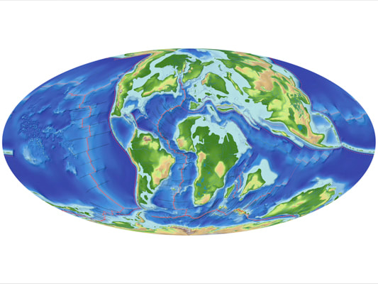
Global Paleogeography
Our atlases of global paleogeography are designed primarily for new ventures groups in resource exploration who are looking for new areas to explore.
We are also working with academic research groups to provide versions of these maps for academic research, primarily investigations into climate and environmental change.
|
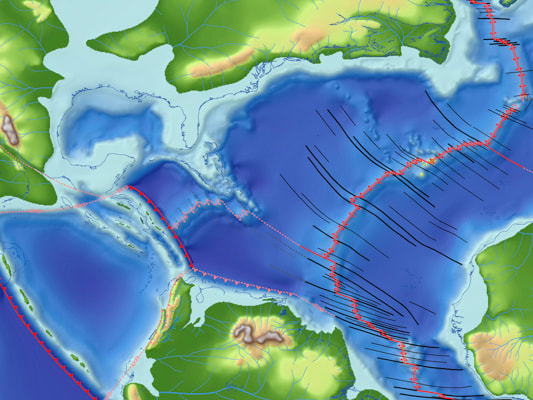
Regional Paleogeography
The regional atlases are designed for resource asset teams who already have a presence in an area and want to understand the juxtaposition of tectonics, geology, and surface processes that may affect the distribution of the natural resources they are exploring for.
These atlases include more geological information.
|
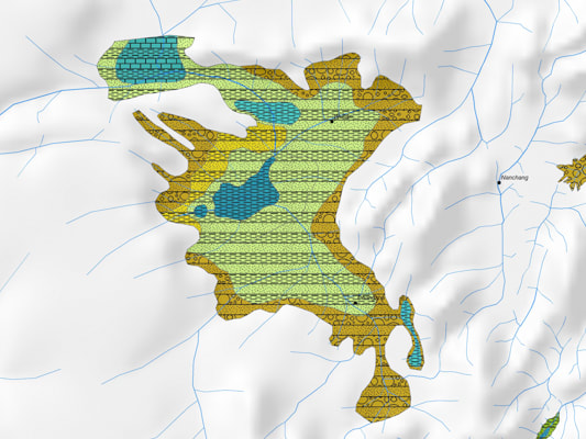
Basin Paleogeography
Basin atlases are the highest resolution that we provide as multi-clients.
|
Paleogeography as a service
We can enhance your existing in-house paleogeographies using our new workflow and in-house knowledge base. This will enable you to get more from your existing internal assets and 3rd party materials.
If this sounds of interest, please get in touch with us directly [email protected] |
Paleogeography as the context for teaching Earth system science
During the pandemic, we have been building lecture courses using paleogeography as the context. If you would like to know more or whether these might be useful for your courses, don't hesitate to get in touch with us [email protected]
|