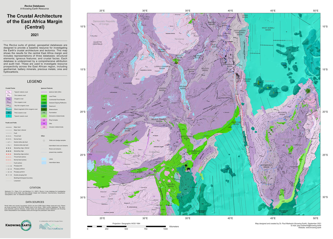
An example of the Reclus geospatial databases based on our forthcoming paper in G-cubed (Markwick et al 2021).
To celebrate Earth Day 2022, we released a high resolution, A0 pdf version of this poster which you can download by clicking on the poster image (pdf format, 53MB) Feel free to print this out for your University, College, School or place of work to use as a starting point to develop your own understanding of the Earth. We are now working on our 2024 updates, so we would welcome all feedback and suggestions. |
Welcome to Reclus, a Knowing Earth resource built in collaboration with Professor Douglas Paton (www.tectonKnow.com). Reclus comprises a suite of geospatial databases designed to provide the community with a baseline for investigating the tectonics of the Earth. Any geological exploration of the Earth ultimately requires an understanding of its structure and crustal geometry and composition – its architecture - whether we are searching for hydrocarbons, battery minerals, metals, water, carbon storage reservoirs, or geothermal. Although regional and local databases are available, there is no systematic, global suite of databases for crustal architecture and structure that are accessible by the entire scientific community. This is why we designed Reclus Reclus enables commercial explorationists to more efficiently add to and modify the databases with their own internal data and expertise to give them an advantage. For students and academics, Reclus provides a starting point for further research - it is so much easier to take an existing resource, question it, disagree with it, change it and improve it The Reclus atlases are built from the suite of Reclus structural and tectonic databases, but with additional information added. This includes a synthesis of the tectonic evolution of each atlas area, cross-sections and an assessment of how the tectonics impacts exploration potential for hydrocarbons and minerals, but also geothermal. The baseline databases are designed for community access and will be gradually published as each phase is completed. |
|
The Need to Consider the 'Big Picture'
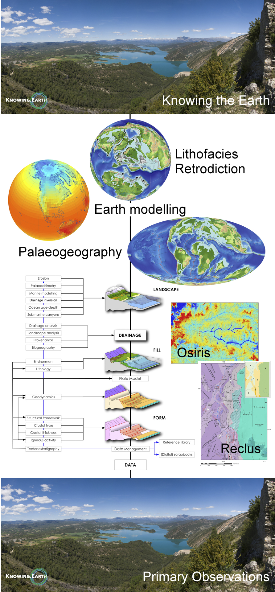
Reclus is one part of an integrated workflow that we use to bring together all the different elements of the Earth System in our search to understand the Earth and to aid in the exploration and management of natural resources.
Only by looking at the whole system can we hope to effectively understand any one part. Beginning with primary observations, through reconstructing the underlying architecture of the Earth, to climate and surface processes, the interaction with the biosphere and ultimately Earth models representing what we know as a way to help us retrodict the past and predict the future. To understand the Earth, first stand back
|
|
|
How?
Interpretations using primary data and the latest published research, underpinned by new systematic workflows, a comprehensive data management system, and data auditing.
For detailed information on how we have built the databases, please see the references cited on this page, or check out our free-to-download articles and blogs on our Resources pages |
Where to see the Reclus databases in action
Update coming soon on our 2024 calendar
|
|
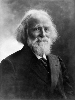
Why the name Reclus?
Choosing a name, as any parent will tell you, is fraught with challenges. Here, we drew inspiration from Jacques Élisée Reclus, a 19th century French geographer whose 19-volume seminal work, ‘La Nouvelle Géographie universelle, la terre et les hommes’ examined the physical and human geography of every continent.
His summary volume, ‘The Earth. A descriptive history of the phenomena of the life of the Globe’, published in English, includes some of the first maps illustrating the global distribution of volcanoes and mountains. Élisée Reclus reminds us of the extremely close link between people and the environment – something that is more relevant now than ever. |
Accessing the Databases
We have four different ways to access our databases. This reflects how we fund the building of the databases, their application, and our mission to provide information to improve our understanding of the Earth System.
|
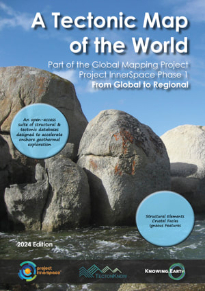
Global Tectonic Map of the World
& Project Innerspace Open Access
Completion of the open-access version of the Reclus suite of databases is being funded by Project Innerspace with a focus on accelerating geothermal exploration and exploitation onshore.
The result will be our new Global Tectonic Map of the World, due for completion at the end of 2024. The Global Tectonic Map of the World comprises three principal geospatial databases: Structural Elements, which defines the structural framework of the Earth; Crustal Facies, describing the crust based on its composition and thickness; Igneous Features (Magmatism), including intrusions and extrusions. Project Innerspace have brought together an amazing collection of international team of academic research groups and companies who are building different components of the project. All with the goal to accelerate geothermal exploration. The results are available openly through Project Innerspace and their new GeoMapTM web tool. A beta version of GeoMapTM showing the initial results for Africa can be found at https://geomap.projectinnerspace.org/map-selection/ Our thanks to Project Innerspace for their support and especially their incredible enthusiasm. |
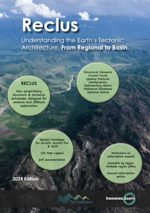
Reclus Commercial (non-proprietary)
The Reclus suite of databases comprises non-proprietary global geospatial databases designed to provide a baseline for resource exploration. This includes hydrocarbon exploration, water, natural hydrogen and helium, critical minerals, and the information needed for CCUS (Carbon Capture, Utilization and Storage) and geothermal.
The principal differences with our open-access databases for Project Innerspace are:
|
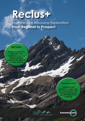
Reclus+ Commercial (proprietary)
The Reclus+ databases are enhanced bespoke versions of Reclus built for and with companies, including the use of company proprietary well, seismic, and other data.
The full workflow integrates into Reclus and Reclus+ with numerical geodynamic modelling, plate tectonic modelling, paleogeography and paleolandscape dynamics, source-to-sink analysis, and lithofacies mapping and modelling. One of the advantages of Reclus+ that we have already seen in areas from NW Africa to Brazil to the Guiana Margin is how this workflow enables us to help companies get more from their existing datasets. It is also a great opportunity to work directly with companies, providing training where/if needed, and insights from other areas around the world that can provide analogues for exploration interests. Please contact us if you would like to learn more about what this includes and our broader exploration workflow. |
Reclus Sponsorship
Another way to support us is by becoming a sponsor of the Reclus research, database build and management. This will help us keep our non-proprietary databases 'evergreen' and accessible. Please contact us if you would like to learn more about this option.
|
Related Publications
Markwick, P.J., Paton, D.A. and Mortimer, E.J. 2021. “Reclus: A new database for investigating the tectonics of the Earth: the East African margin and hinterland”. Geochemistry, Geophysics, Geosystems.
https://doi.org/10.1029/2021GC009897 Markwick, P.J., Paton, D.A. and Mortimer, E.J. 2022. “Mapping the complexity of Transform Margins”. In Tectonic development, thermal history and hydrocarbon habitat models of transform margins, and their differences from rifted margins. Geological Society, London. https://doi.org/10.1144/SP524-2021-8 Paton, D.A., Markwick, P.J., Mortimer, E.J. and Khan, E.M., 2023. “Coeval development of extensional and compressional features along transform margins: insights from the Diaz Marginal Ridge, South Africa”. In Tectonic development, thermal history and hydrocarbon habitat models of transform margins, and their differences from rifted margins. Geological Society, London. https://doi.org/10.1144/sp524-2021-88 Markwick, P.J., Paton, D.A. and Araújo, M. N. C. d., 2024. “Mapping Deformation: the Map Representation of Geological Structure”. In Geological mapping of our world and others: an introduction, edited by R. W. H. Butler, T. Torvela and L. Williams. Geological Society, London. https://doi.org/10.1144/SP541-2023-6 |
Further Information
Additional background on the individual Reclus databases can be found in our Resources section. Please do not hesitate to contact us directly for further information: [email protected]
|