|
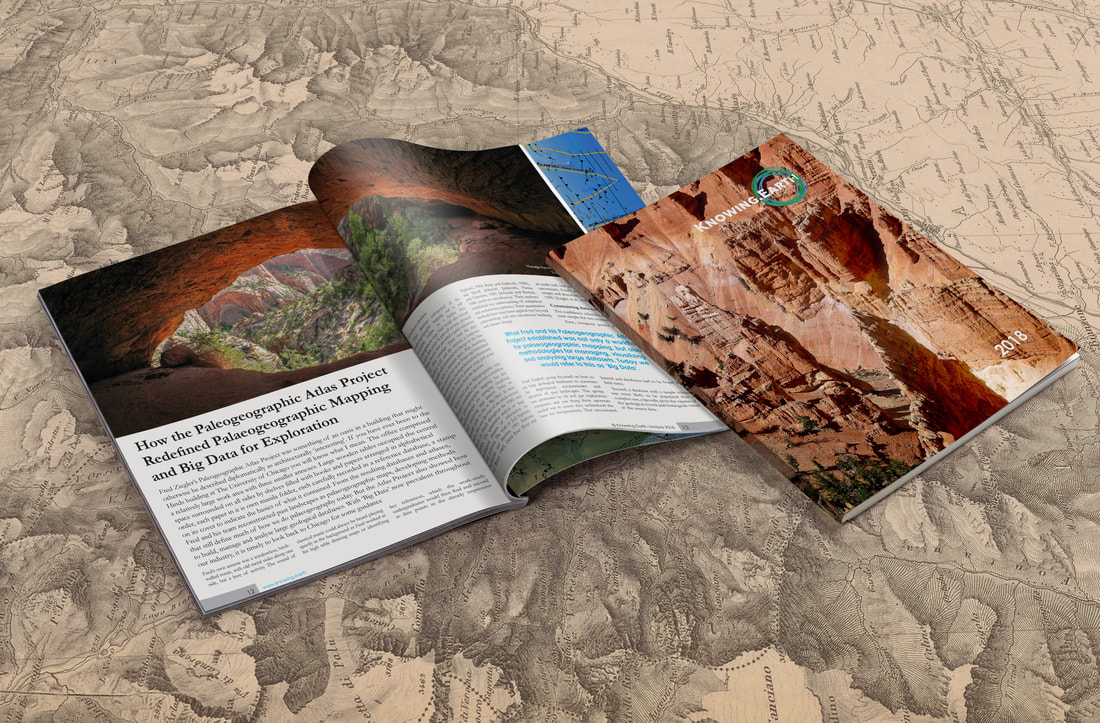
The Knowing Earth Review is an annual publication designed to provide Earth scientists and explorationists with an introduction to the Earth system. This is done through paleogeography, which provides the spatial and temporal context for gathering, managing, analysing and visualizing the diversity of components and processes that make up the system, and whose interaction shapes the Earth. This includes topics ranging from tectonics and mantle convection, crustal architecture and structure, paleogeographic mapping and depositional systems, Earth system modeling, drainage analysis and paleohydrology, lithofacies retrodiction and biodiversity. This review may be especially useful for new staff and students who have not experienced the ‘big picture’ approach before, or for the coffee room to stimulate interest and discussion. The 2019 edition will be released at AAPG 2019 in San Antonio. The Review is freely distributed as a printed copy to sponsors of our partner university research groups and to clients of Knowing Earth. The 2018 issue can now be downloaded for free as a pdf at the following location. PDF 2018 Edition Contents Welcome to Knowing Earth Editors Letter Part of geology’s appeal is its breadth and diversity, bridging the divide between the humanities and the ‘pure’ sciences, borrowing elements from all. Whether we call ourselves ‘geologists’, ‘Earth scientists’ or ‘geoscientists’, the key to understanding the Earth is considering how all the components of the Earth system fit together, interact and evolve through time. But this breadth and diversity come at a cost and nowhere more so than when applied to oil and gas exploration. How the Paleogeographic Atlas Project Redefined Paleogeographic Mapping and Big Data for Exploration Fred Ziegler’s Paleogeographic Atlas Project was something of an oasis in a building that might otherwise be described diplomatically as architecturally ‘interesting’. If you have ever been to the Hinds building at The University of Chicago you will know what I mean. The office comprised a relatively large work area with three smaller annexes. Large wooden tables occupied the central space surrounded on all sides by shelves filled with books and papers arranged in alphabetical order, each paper in it is own manila folder, each carefully recorded in a reference database, a stamp on its cover to indicate the basics of what it contained. From the resulting databases and atlases, Fred and his team reconstructed past landscapes as paleogeographic maps, developing methods that still define much of how we do paleogeography today. But the Atlas Project also showed how to build, manage and analyze large geological databases. With ‘Big Data’ now prevalent throughout our industry, it is timely to look back to Chicago for some guidance Revealing the Earth’s Architecture When Thomas Sterry Hunt first coined the phrase “paleogeography” to describe the reconstruction of the Earth’s geography through time (Hunt, 1873), his workflow began with an understanding of what he referred to as the “architecture” of the Earth. By architecture, he was describing the Earth’s structural framework, crustal geometry and composition, and geodynamics, which today we define broadly within the concept of “Crustal Architecture”. From Source to Sink: the Importance of Drainage Reconstruction Source-to-sink has become a key concept in exploration, especially for understanding and predicting reservoir facies character and distribution. Source-to-sink follows the path of a particle from its formation through weathering in the basin hinterland, to burial and preservation in a sink area via erosion and transport (Martinsen et al., 2010; Sømme et al., 2009). This is a complex journey that requires an understanding of a wide range of subjects from tectonics to climate, weathering and erosion, transport mechanisms and depositional systems. Modelling the Earth System for Exploration: why some Models are Useful “All models are wrong, but some are useful” George Box (Box and Draper, 1987) George Box’s quote has become something of a cliché and one I have frequently heard when promoting the use of climate and lithofacies models in exploration over the past 20 years. Though the usual riposte I receive is with an emphasis on “all models are wrong”. The scepticism levelled especially at climate modelling has many ‘justifications’: “models are not data”, “there are too many uncertainties”, “yesterday’s weather forecast was wrong so how can I believe a climate model?”, “climate change is not real, so the models must be wrong”, “models are models”. Followed by the frequent question “do you have any seismic?”. Bringing it all Together: the View from the Field The 11th century Castillo de Samitier sits precariously upon a Paleocene limestone ridge some 450 metres high above the Río Cinca that winds its way south through the gorge below. All that remains of the ‘castle’ is a small chapel, the Ermita de San Emeterio y San Celedonio, and a single defensive tower, a second having long since fallen into the narrow gorge below. From the castle, you can see in one view how tectonics, landscape, climate, deposition interacted some 50 million years ago, and how they interact today. The view is breath-taking, but highlights a problem, there is simply so much to take in. Creating a Legend Maps are a means of visualizing spatial information. As such, they need a map legend that conveys that information through colour or ornamentation as simply and clearly as possible. In geology, there is a long tradition of colouring and coloured maps, with ‘relatively’ standardized symbologies for chronostratigraphy (geological time), structural elements and lithologies. Further Information Knowing Earth is about building partnerships and ensuring that all members have a common suite of baseline databases with which to build understanding. For further information, whether commercial or academic, please contact myself or my colleagues. A pdf version of this blog is available here. PDF
0 Comments
Leave a Reply. |
AuthorDr Paul Markwick Archives
November 2023
Categories |
|
Copyright © 2017-2024 Knowing Earth Limited
|
E-mail: [email protected]
|

